Luna Fm
Type Locality and Naming
Subsurface: Interval 945 to 1080 m in well Banni-2 (Zutshi et al., 1993)
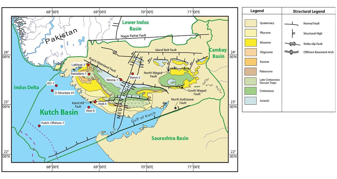
[Fig. Geological and structural map of Kutch, also showing the onshore and offshore wells drilled for oil exploration. (Map by Rasoul Sorkhabi in GeoExpro Dec2014, based on various sources including S.K. Biswas, Current Science, 25May2005)]
Lithology and Thickness
Claystone. It consists of shale, limestone and sandstone with alternations of shale, thin coal bands and carbonaceous matter, while silty shale occurs towards the middle part of section. In Banni-2 it is 135 m, it is 60 m thick in Nirona well
Relationships and Distribution
Lower contact
Unconformable with underlying Lodai Fm
Upper contact
Unconformable with Jumara Fm
Regional extent
GeoJSON
Fossils
Age
Depositional setting
The sediments exhibit current bedding and incipient cyclothemic characters, between coal shale and limestone, indicating paralic environment
Additional Information
